Planning Aerial Imaging with Google Earth
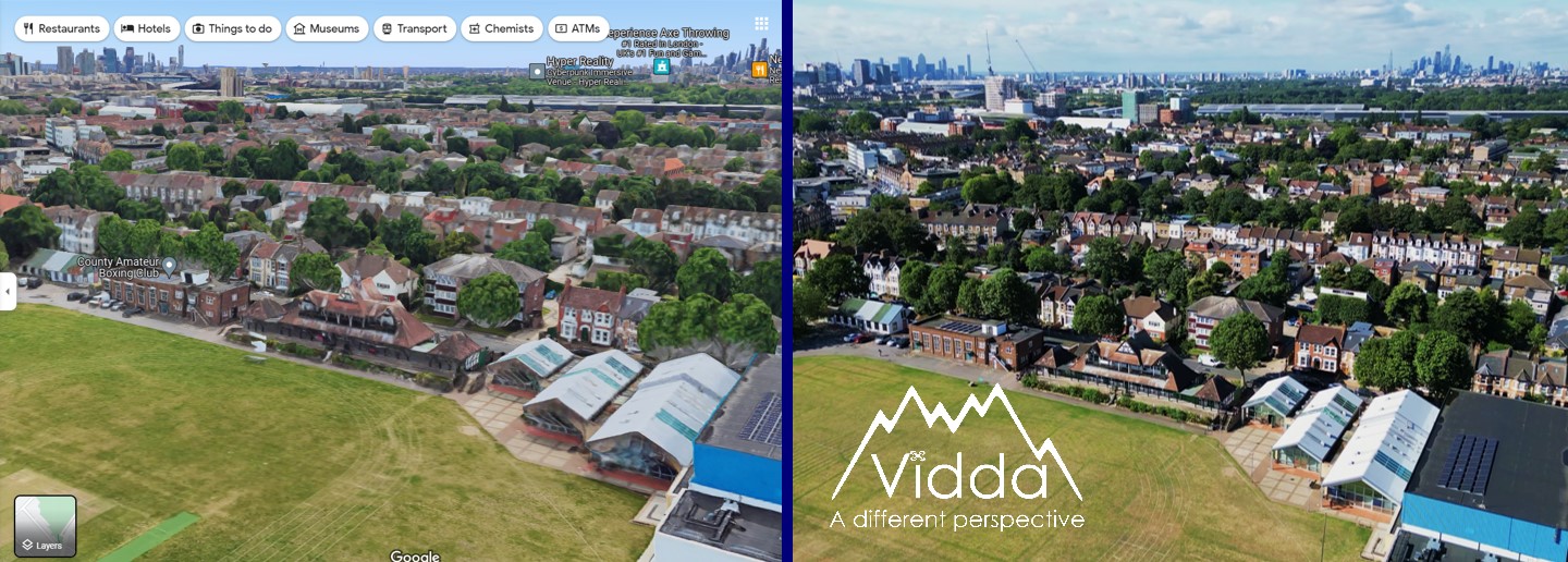
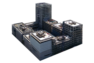
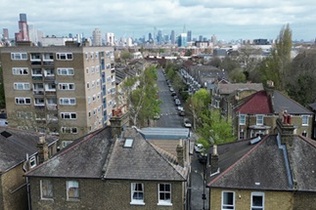
Google Earth 3D image (L) vs Vidda drone photo (R)
Updated 9th June 2024, by Jack
Drone Photography Planning
Drone photography is a fantastic tool for advertising property listings, showcasing businesses, and documenting projects with stunning visuals. It provides detailed images from almost any angle, significantly enhancing your marketing materials and enables inspection of previously inaccessible areas. While it offers numerous benefits, it's important to consider the associated costs and the challenges of visualizing the final result. Utilising 3D imaging sites like Google Earth can help you explore all angles of a project beforehand, guiding your shot selection and identifying any obstacles that might affect the drone’s filming process.
How to Use Google Earth for Drone Planning
- Open Google Earth
Start by opening Google Earth. If you don’t have it installed, you can access the webiste here. Whilst there is also a mobile app, we recommend using the desktop version for full functionality.
- Enter the Address
Type the address of the location you want to view into the search bar. This will take you to the desired location.
- Switch to 3D View
In the bottom right corner, press the “3D” button. This changes the angle from a vertical satellite view to an angled 3D view.
- Navigate the 3D View
- Move the virtual camera: Click and drag the mouse to move the camera position.
- Rotate the camera view: Hold the shift key, click, and drag the mouse to rotate the camera view around a fixed point on the ground.
- Pan the camera: Hold the ctrl key, click, and drag the mouse to pan the camera, keeping its position fixed but changing the direction of the view.
What to Look For
- Explore Different Angles and Heights
Move the camera to different positions to get various perspectives of your target. Experiment with different angles and camera heights to find the best shot.
- Identify Background Elements
Look for background elements that may stand out positively or negatively. Ensure the background complements your main subject without distractions.
- Spot Obstacles
Identify obstacles like electric pylons, trees, or buildings that could obstruct the shot or prevent the drone from reaching the desired location.
Taking Screenshots
As you explore the different views, take screenshots or snips of your favorite angles and points of interest. If you are outsourcing your aerial imaging project, sharing these screenshots with the company will help them recreate your vision accurately.
Limitations
- Resolution
While Google Earth is a powerful tool for visualizing large areas and getting a sense of geography, it has limitations in terms of image resolution and accuracy. This makes it less suitable for tasks requiring high detail and precision, such as close-up inspections, roof surveys and advertising. The low resolution and the way images are stitched together mean that the photos often lack the clarity and consistency needed for professional marketing materials.
- Up-to-Date Imagery
Google Earth images may not always be up-to-date. For rapidly changing projects like recent construction sites, the images might not accurately represent the current state.
- Seasonal Differences
Consider the season depicted in Google Earth. A winter view can look significantly different in summer when foliage changes the landscape.
Optimize Your Aerial Shots with Google Earth
Google Earth in 3D mode is a powerful tool for planning drone photography, here at Vidda we use it on all jobs before sending a quote. It allows you to visualise different angles, identify potential obstacles, and plan your shots effectively, ensuring a successful aerial imaging project. Don't forget that lining up the best shots is just part of the process for planning aerial photography, check out our article on drone flying in London to make sure you get the correct permissions.